
Asia-Pacific E-Resilience Toolkit Tool
Bhutan Forest Fire Detection and Monitoring System
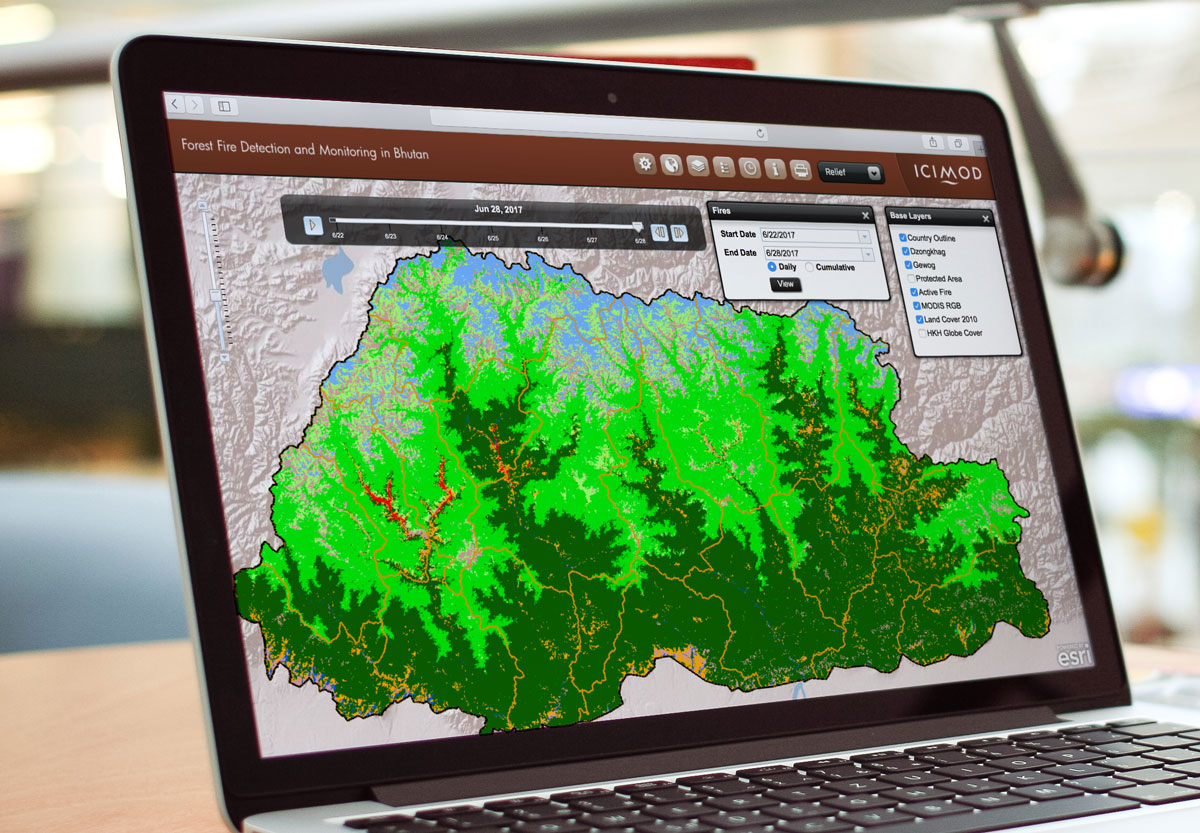
For Bhutan, there is a clear need for reliable and time-effective information on forest fires. To this regard, satellite imagery has found to be useful in fire detection and monitoring, and burnt area assessment on near real-time basis. To this regard, the International Centre for Integrated Mountain Development (ICIMOD) has developed a forest fire detection and monitoring system for Bhutan in close collaboration with the Department of Forests of Bhutan.
The system facilitates data acquisition, processing, and reporting of fire location information in an automated manner. Hence, the interactive online mapping application allows visualization of active fire locations on any given day along with dzongkhag level fire count statistics.
The system is publicly accessible over the Internet. A user is able to select a certain time period to view the fire events using a time-slider tool.


