
Asia-Pacific E-Resilience Toolkit Tool
FFCW Flood Forecasting & Warning Centre
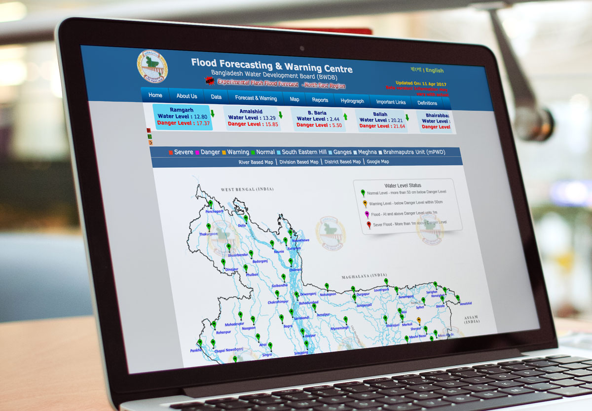
The Flood Forecasting & Warning Centre(FFWC) provides rainfall and water level tables, forecasting and warnings through structure based forecasting, experimental 5 day deterministic forecasting, and satellite altimetry. It provides a real time water level map of Bangladesh showing normal, warning, flooding, and severe flooding (danger level). Physical water level readings are obtained through water level monitoring stations.
FFWC through its Forecasting and Warning Services (FFWS) generates and provides flood forecasts and warning information to enhance the disaster management capacity of national agencies and communities using the best scientific principles, real time data, weather forecast information and mathematical models. The aim is to act as a centre of emergency response through FFWS to minimize or mitigate loss of life and property damage by enhancing capacity of agencies and communities. The center works with partners to continuously update and improve FFWS and the capacity of professionals. The Ministry of Water and Resources (MoWR) through the Bangladesh Water Development Board provide these services.
Floods in Bangladesh are divided into monsoon river floods, flash floods, local rainfall floods and storm surge floods. Inflow through the Ganges, Brahmaputra and Meghna Rivers and rainfall causes the water level in the rivers to rise and fall during the monsoon season. To predict water level conditions in Bangladesh FFWC collects measurements of water level and rainfall, satellite pictures and simulates the water level conditions by use of a numerical model of the Bangladeshi river network. Every day during most of the monsoon season the model simulates the water level conditions during the previous 7 days (hind-cast simulations) and during the coming 3 days (forecast simulation). More precisely the forecasting starts during early monsoon when one of measuring stations shows a water level 60 cm below danger level. The model is named the "Super Model" and is based on measurements of the topography of Bangladesh and the general numerical hydrodynamic model system named MIKE 11 developed at DHI Water & Environment.
This type of modelling tool, even though there are margins of error associated with it, is considered vital in flood prediction and risk reduction. E-resilience is enhanced through continuous improvements to modelling techniques, physical gauges and readings, and computing power.


