
Asia-Pacific E-Resilience Toolkit Tool
InaSAFE Hazard Impact Scenario Software
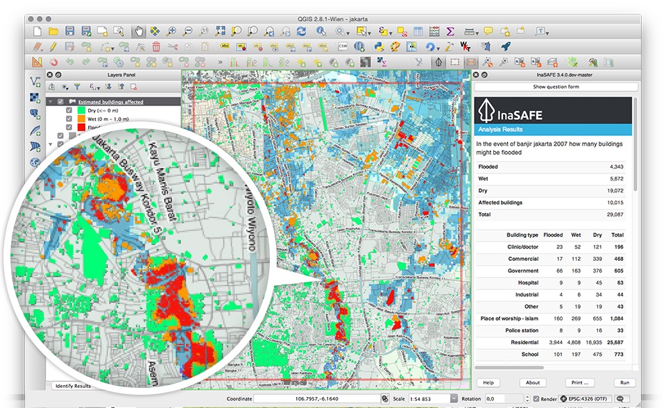
InaSAFE is free software that produces realistic natural hazard impact scenarios for better planning, preparedness and response activities. It provides a simple but rigorous way to combine data from scientists, local governments and communities to provide insights into the likely impacts of future disaster events.
The software enables production of realistic natural hazard impact scenarios for better planning, preparedness and response training activities, by incorporating a range of natural hazard information, such as earthquake, volcanoes, tsunami or flood; and exposure data, such as the spatial distribution of population, roads or critical infrastructure.
InaSAFE is designed to use and combine existing and new data from communities, local governments and science agencies. In the absence of available spatial data, external tools such as OpenStreetMap are available for communities and disaster managers.
InaSAFE has been jointly developed by the Indonesian Government-BNPB, the Australian Government, the World Bank-GFDRR and independent contributors. The software is compatible with the free and open source Geographic Information System QGIS 2.0, and allows users to import spatial data from remote sources and create custom impact map templates.


