
Asia-Pacific E-Resilience Toolkit Tool
J-SHIS Seismic Hazard Maps Japan
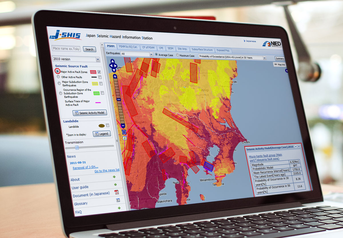
J-SHIS was established to help prevent and prepare for earthquake disaster by providing a public portal for seismic hazard information across Japan. The offered maps contain a lot of information including the data required for mapping such as seismic activity models, seismic source fault models, subsurface structure models, and other models.
The National Seismic Hazard Maps for Japan is prepared by a governmental organization, the Headquarters for Earthquake Research Promotion (HERP) to estimate strong motions caused by earthquakes that could occur in Japan in the future and show the estimated results on the maps.
The National Seismic Hazard Maps for Japan consist of two types of maps different in nature: the Probabilistic Seismic Hazard Maps (PSHM) that combine long-term probabilistic evaluations of earthquake occurrence and strong motion evaluation, and the Seismic Hazard Maps for Specified Seismic Source Faults (also referred to as Scenario Earthquake Shaking Maps (SESM) in J-SHIS), which are based on strong motion evaluation for scenarios assumed for specific earthquakes.


