
Asia-Pacific E-Resilience Toolkit Tool
Volcanoes & Earthquakes Application
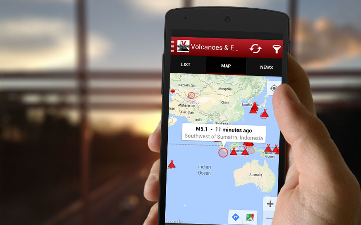
The Volcanoes & Earthquakes smartphone application shows the latest earthquakes and active volcanoes on a map and as list. A user can filter the data shown in various ways, e.g. by magnitude or age of earthquakes, the distance from one's location, the status of volcanoes and so on. Hence, the application has the potential to enhance awareness of vulnerable communities in Asia and the Pacific with regards to earthquakes and volcanic eruptions.
With regard to volcanic eruptions, among others, users can: see currently erupting volcanoes on a map, receive volcano alerts (through push notifications), and receive volcanic ash advisories. With regard to earthquakes, among others, users can receive earthquake alerts (with customized notifications), a map of tectonic plate boundaries, recent earthquakes, and submit experience reports alongside location.
Data presented in the application are continuously being collected and updated from various public sources, mainly international agencies such as USGS, GFZ, EMSC, as well as volcanodiscovery.com. The application is currently available only on the Android mobile operating system.


